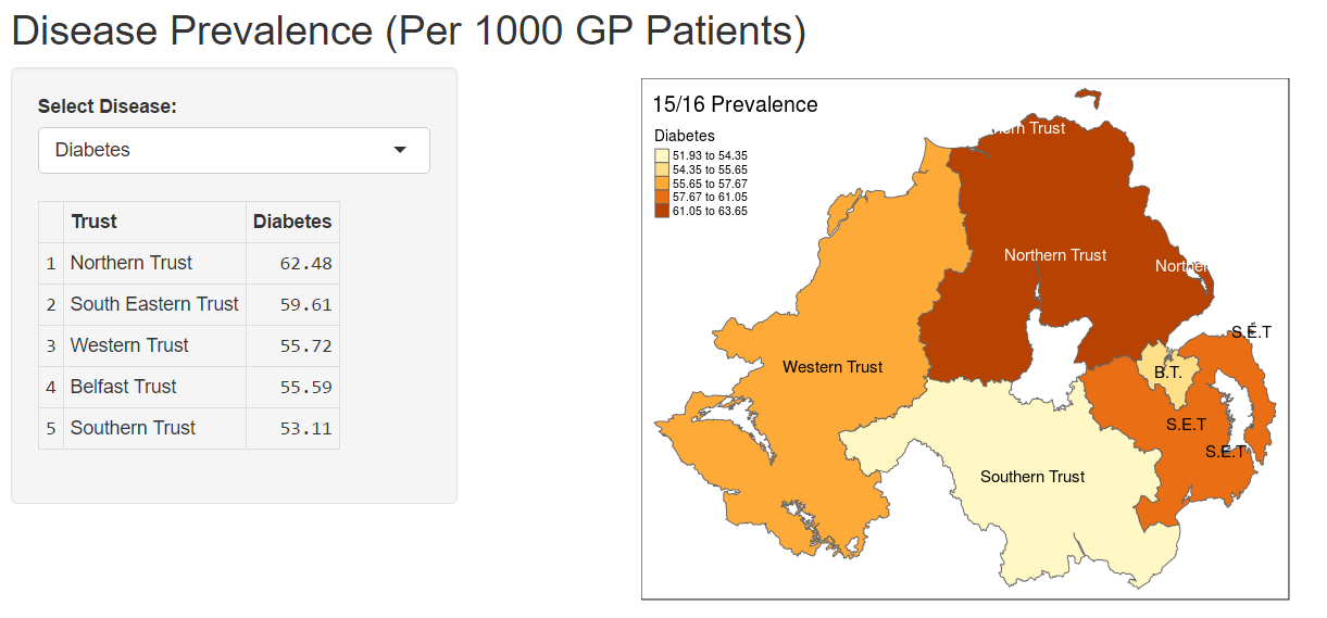
Disease prevalence varies geographically and can provide important information to public health and policy makers about how best to deliver health services regionally. This web app uses publicly available data about geography and disease prevalence to visualise variations by health service trust geography. This facilitates exploration of the prevalence differences across a range of important diseases in Northern Ireland.
In keeping with the open theme, the app was developed entirely in R, an open source statistical programming language. The app was developed using the R shiny package, with the data processing and visualisation carried out using tmap, dplyr, and ggpot2.
The link to the site is below (under the launch website link) however you can read up on the background of the work here http://www.byrongraham.co.uk