-

Bike Parking Belfast
Bike Parking Belfast is an Alexa skill which harnesses an OpenDataNI dataset ('Belfast Cycle Map') and the location services on your device to find the closest bicycle parking...1 dataset View Bike Parking Belfast -
Visualising the N.I. bus network: you wait for ages, and 3,743 show up at once
Translink recently made available their set of Ulsterbus, Goldline and Metro timetables and routes on Open Data NI. We combined these data sets to find the expected position of...4 dataset View Visualising the N.I. bus network: you wait for ages, and 3,743 show up at once -
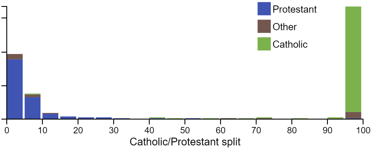
The continuing religious divide in Northern Ireland’s schools
I’ve combined the data from Kathryn Torney’s 2012 guardian article (https://www.theguardian.com/news/datablog/2012/nov/24/religious-divide-northern-ireland-schools) and more...2 dataset View The continuing religious divide in Northern Ireland’s schools -
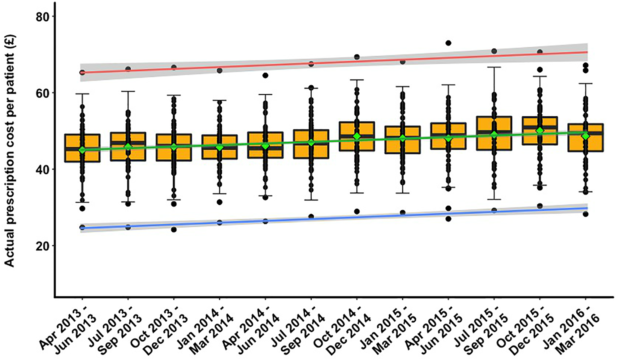
Prescriptive variability of drugs by general practitioners
Northern Ireland (NI) has the highest prescription rate in the UK with the cost of prescribing (£440m in 2015) greater than the yearly budget of some Stormont departments. The...1 dataset View Prescriptive variability of drugs by general practitioners -
Emergency Care Waiting Times
This Showcase utilises TableauPublic to visualise the Emergency Care Waiting Times dataset that records the number of patients waiting at each of Northern Ireland’s hospitals....1 dataset View Emergency Care Waiting Times -
Find your public amenities in Northern Ireland
You can read all about how I created this showcase and the background to it here.24 dataset View Find your public amenities in Northern Ireland -
Belfast Bike Hire Rentals & Returns
You can read all about how I created this showcase and the background to it here.2 dataset View Belfast Bike Hire Rentals & Returns -

"My Train" for Amazon Echo
Access real time train information with the help of Alexa on Amazon Echo and Translink's Real Time Rail data feed, accessible on OpenDataNI. By creating the free Amazon Echo “My...1 dataset View "My Train" for Amazon Echo -
Analysis of the trees of Belfast
The work utilises open data provided by the Belfast City Council on the Open Data NI website Belfast Trees. I carried out an in-depth analysis of the trees of Belfast, applying...1 dataset View Analysis of the trees of Belfast -
Notifiable Infectious Diseases Reports (NoIDs) Northern Ireland | Trends &...
The OpenDataNI website holds Notifiable Infectious Diseases Reports, provided by the Public Health Agency. The available data runs from Week 50 2014 to (at the time of writing)...0 dataset View Notifiable Infectious Diseases Reports (NoIDs) Northern Ireland | Trends & Predictions -
Prescriptions Cost Savings
Taking the GP Prescribing data published so far to date, we've examined how prescribers could identify cost savings in their choice of treatment. Based on the influential work...1 dataset View Prescriptions Cost Savings -
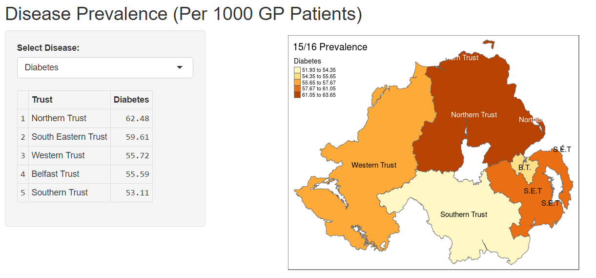
Disease Prevalence in Northern Ireland
Disease prevalence varies geographically and can provide important information to public health and policy makers about how best to deliver health services regionally. This web...2 dataset View Disease Prevalence in Northern Ireland -
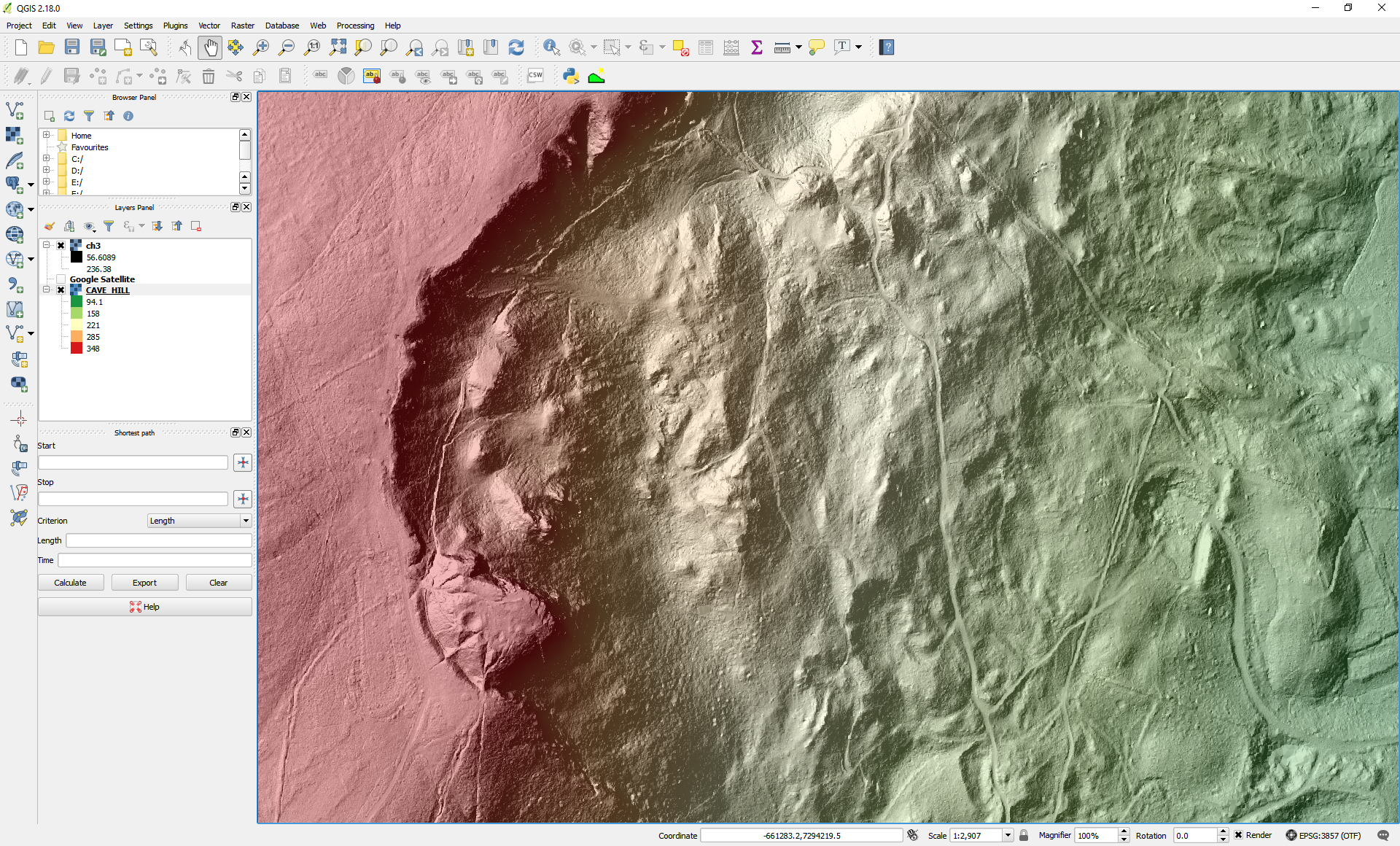
What's under the trees? Visualising OpenDataNI LiDAR in a Geographical...
A blog describing the steps to process, visualise and analyse the OpenDataNI LiDAR data (Raster/Grid forma) using a free and open source Geographical Information System (GIS).1 dataset View What's under the trees? Visualising OpenDataNI LiDAR in a Geographical Information System (GIS) -
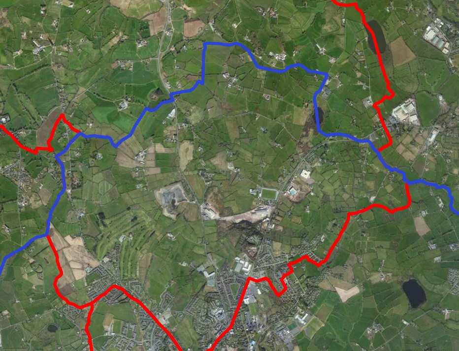
Boundary Review
Parliamentary constituencies across the UK are currently under review, as the number of seats at Westminster are being reduced to 600. In Northern Ireland, this means a...1 dataset View Boundary Review -
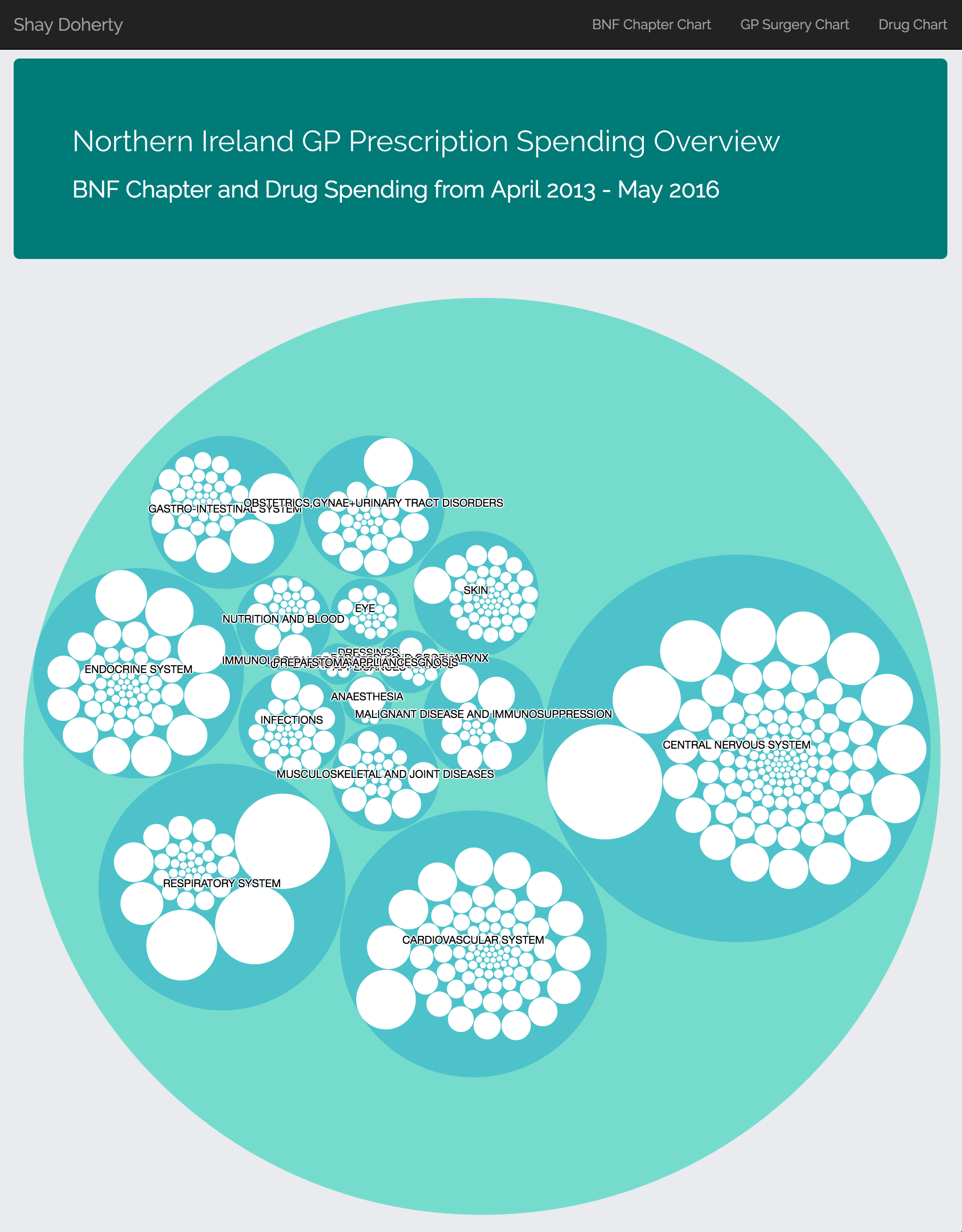
GP Prescription Spending by British National Formulary (BNF) Chapter and...
The GP Prescription data was sucked into a Microsoft Azure Cloud Database and aggregated. The aggregated data was then exported as JSON and the visualisation was created using...1 dataset View GP Prescription Spending by British National Formulary (BNF) Chapter and Drug April 2013 - May 2016 -
Northern Ireland Road Traffic Collision Data 2013-15: A visualisation of the data
This visualisation looks at the numbers of Killed and Seriously Injured on NI's roads for 2013 to 2015. User-controlled filters allow personalised drill-downs into the dataset.3 dataset View Northern Ireland Road Traffic Collision Data 2013-15: A visualisation of the data -

WhyLiveHere?
Buying a house? Renting a flat? Ever wonder what is around the property you're looking at? Or perhaps you are just curious to look? WhyLiveHere? plots the information on a map...4 dataset View WhyLiveHere? -
Using Machine Learning to Extract Useful Information about Belfast Trees
In this coursework, two machine learning models were created to allow us to extract useful information about the trees in Belfast. This information could be used to aid the...1 dataset View Using Machine Learning to Extract Useful Information about Belfast Trees -
NI GP Prescribing Data November-December 2015
I wanted to see what I could do with the GP Data using Tableau Public - the answer is 'not as much as I'd like' - the data sets are really too large for this platform, so I was...1 dataset View NI GP Prescribing Data November-December 2015 -
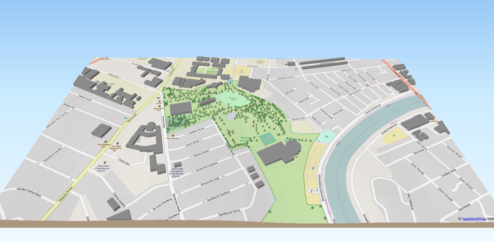
Botanic Gardens 3D Tree Model
Using the Belfast tree database from OpenDataNI along with other open spatial datasets (elevation and openstreetmap) a 3D interactive model has been created for Botanic Gardens....1 dataset View Botanic Gardens 3D Tree Model -
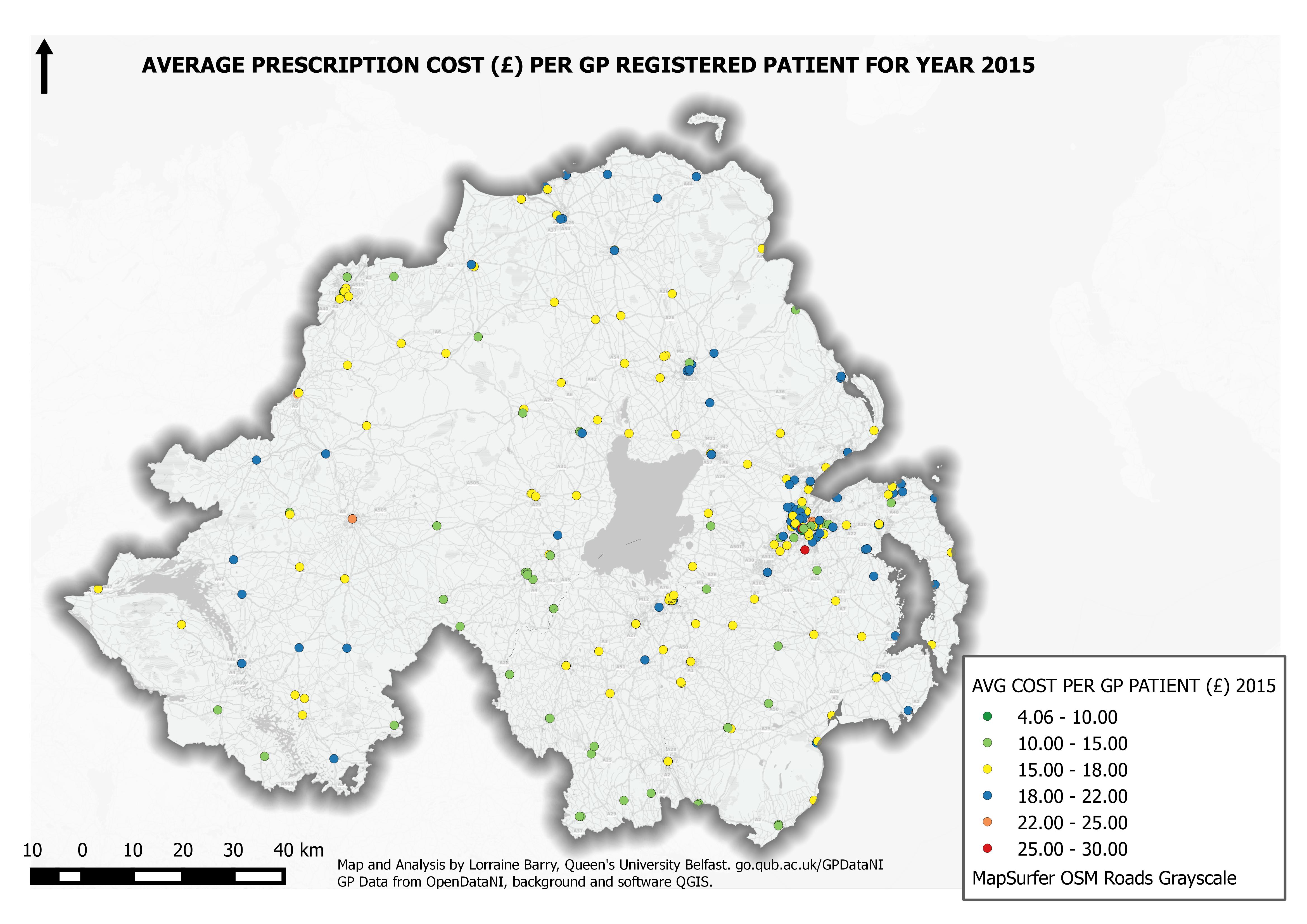
Average 2015 Prescription Costs for GP Practices in Northern Ireland
A overview of prescription costs in Northern Ireland for 2015 based on averaged monthly quantities and cost per registered GP patient organised by GP practice. Each GP practice...1 dataset View Average 2015 Prescription Costs for GP Practices in Northern Ireland -
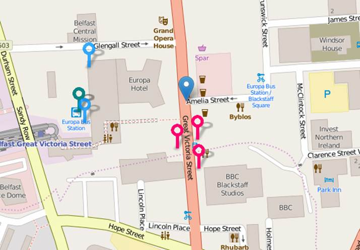
Find your nearest bus stops
You can now find where and how close your nearest bus stops are online, using open data published by Translink. At the moment, you're not able to find where your nearest bus...2 dataset View Find your nearest bus stops -
The Public Trees of Belfast City
The Belfast City Council Open Data Tree Database details the species and location of 15,500 'Public' trees in the cityscape (Park & Street). The data includes information on...1 dataset View The Public Trees of Belfast City