ArcGIS GeoService
Dataset description:
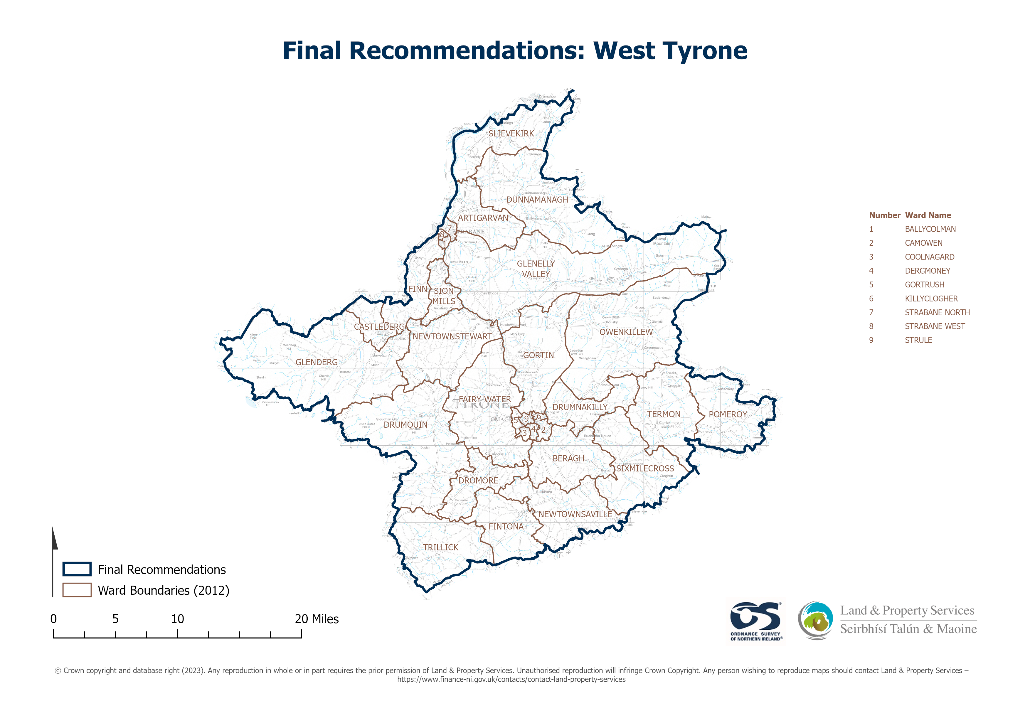
Raster download of Parliamentary Constituency 2023 of West Tyrone. The OSNI Large-scale Parliamentary Constituencies boundaries is a dataset consisting of official boundaries as agreed by...
Avots: OSNI OpenData - Parliamentary Constituencies 2023 - West Tyrone
Šim resursam pašreiz vēl nav izveidots skats.
Papildus informācija
| Lauks | Vērtība |
|---|---|
| Metadata last updated | 2025. gada 27. augusts |
| Izveidots | 2025. gada 27. augusts |
| Formāts | JSON |
| Licence | UK Open Government Licence (OGL) |
| Access url | https://docs.spatialni.gov.uk/OpenData/OSNIOpenData_ParliamentaryConstituencies2023/PC2023_West_Tyrone.png |
| Datastore active | False |
| Distribution ref | Na150128b55c745f5b42a492eb76d3166 |
| Has views | False |
| Id | 79dcf52b-dd4f-4f54-93d8-71a213226574 |
| Mimetype | application/json |
| Package id | 85334ea2-ec45-41b0-b9b3-7360bc30f6e9 |
| Position | 1 |
| Requested | False |
| State | active |