ArcGIS GeoService
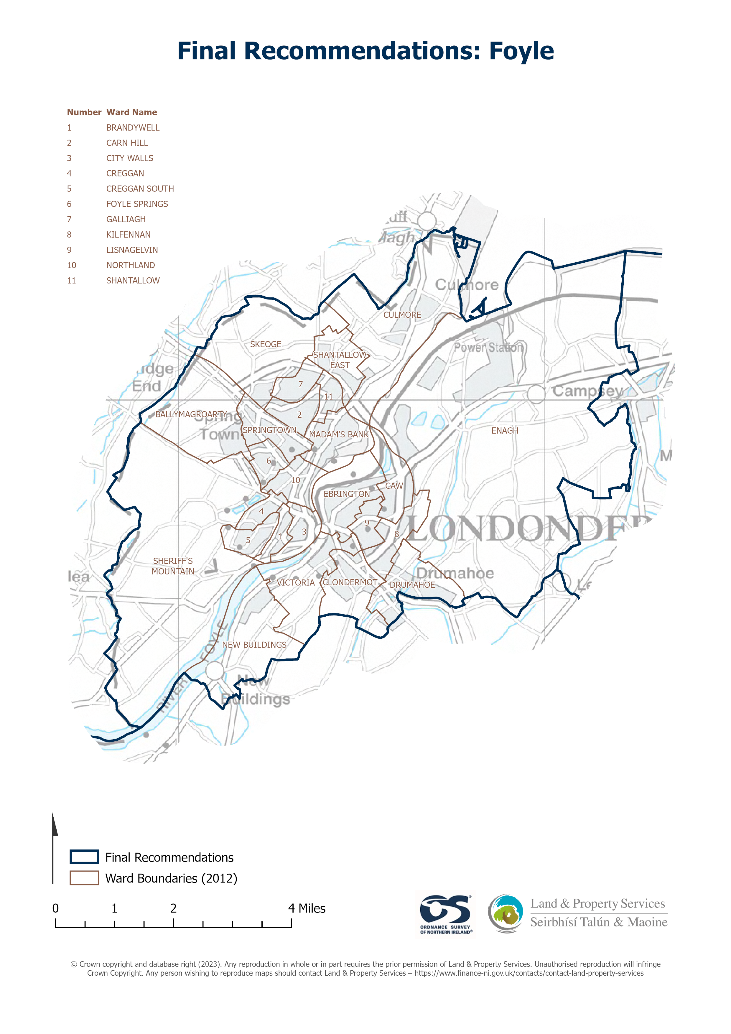
URL: https://docs.spatialni.gov.uk/OpenData/OSNIOpenData_ParliamentaryConstituencies2023/PC2023_Foyle.png
Dataset description:
Raster download of Parliamentary Constituency 2023 of Foyle. The OSNI Large-scale Parliamentary Constituencies boundaries is a dataset consisting of official boundaries as agreed by The...
Source: OSNI OpenData - Parliamentary Constituencies 2023 - Foyle
There are no views created for this resource yet.
Additional Information
| Field | Value |
|---|---|
| Metadata last updated | September 21, 2024 |
| Created | September 21, 2024 |
| Format | JSON |
| License | UK Open Government Licence (OGL) |
| Datastore active | False |
| Has views | False |
| Id | 5ad600fd-d155-4628-a751-e355fdc2e796 |
| Mimetype | application/json |
| Package id | ee9ecb9b-a744-420d-9585-be0b43f79e98 |
| Position | 0 |
| Requested | False |
| State | active |
| Uri | None |