ArcGIS GeoService
Dataset description:
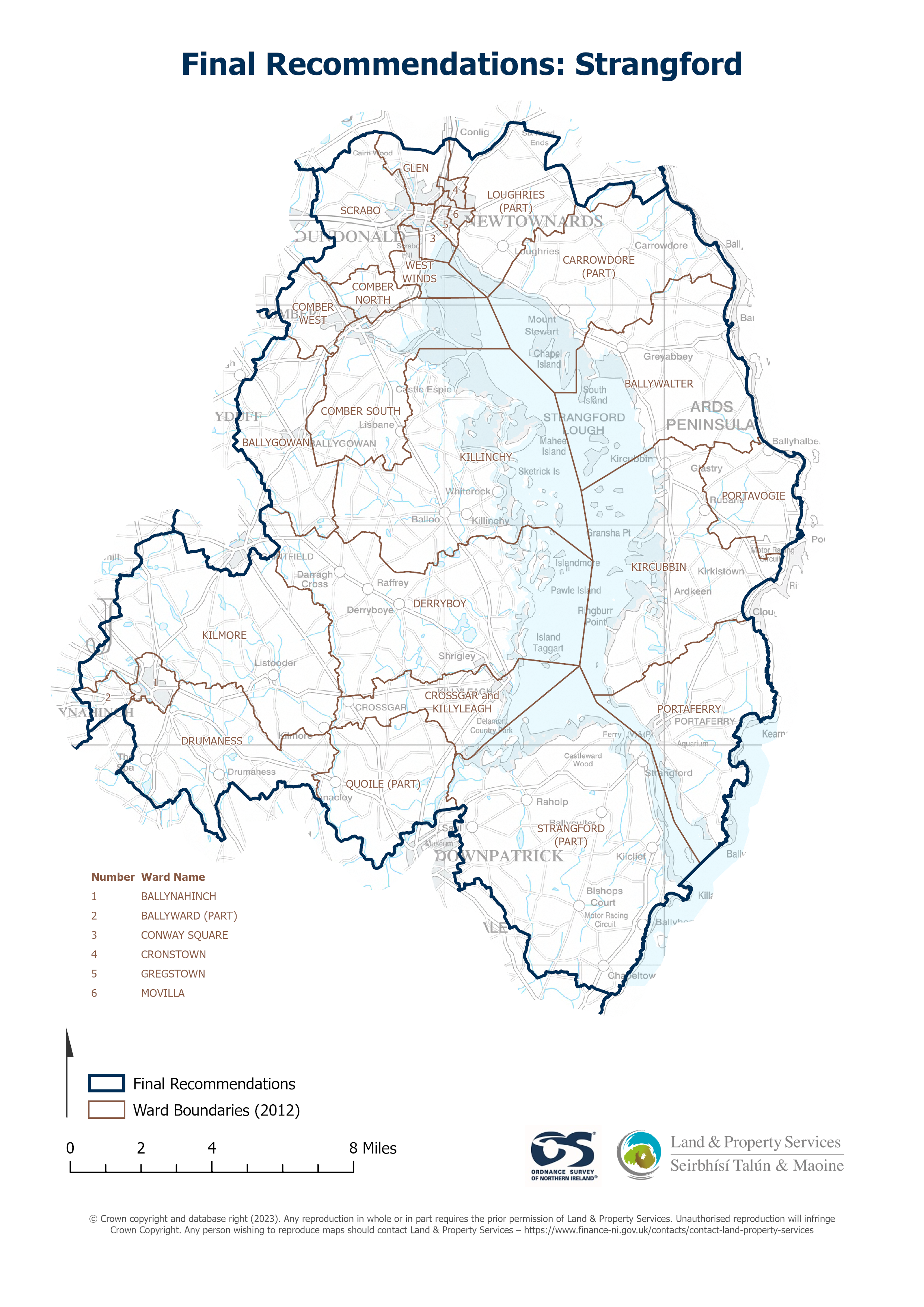
Raster download of Parliamentary Constituency 2023 of Strangford. The OSNI Large-scale Parliamentary Constituencies boundaries is a dataset consisting of official boundaries as agreed by...
Avots: OSNI OpenData - Parliamentary Constituencies 2023 - Strangford
Šim resursam pašreiz vēl nav izveidots skats.
Papildus informācija
| Lauks | Vērtība |
|---|---|
| Metadata last updated | 2025. gada 27. augusts |
| Izveidots | 2025. gada 27. augusts |
| Formāts | JSON |
| Licence | UK Open Government Licence (OGL) |
| Access url | https://docs.spatialni.gov.uk/OpenData/OSNIOpenData_ParliamentaryConstituencies2023/PC2023_Strangford.png |
| Datastore active | False |
| Distribution ref | N89a31e740dd74dbf84d0fd2419e9d844 |
| Has views | False |
| Id | e76232f4-39df-4607-b7ec-ddca00439f8b |
| Mimetype | application/json |
| Package id | 47ed4aaf-64a3-49dd-a5c6-b437e932ba39 |
| Position | 1 |
| Requested | False |
| State | active |