ArcGIS GeoService
Dataset description:
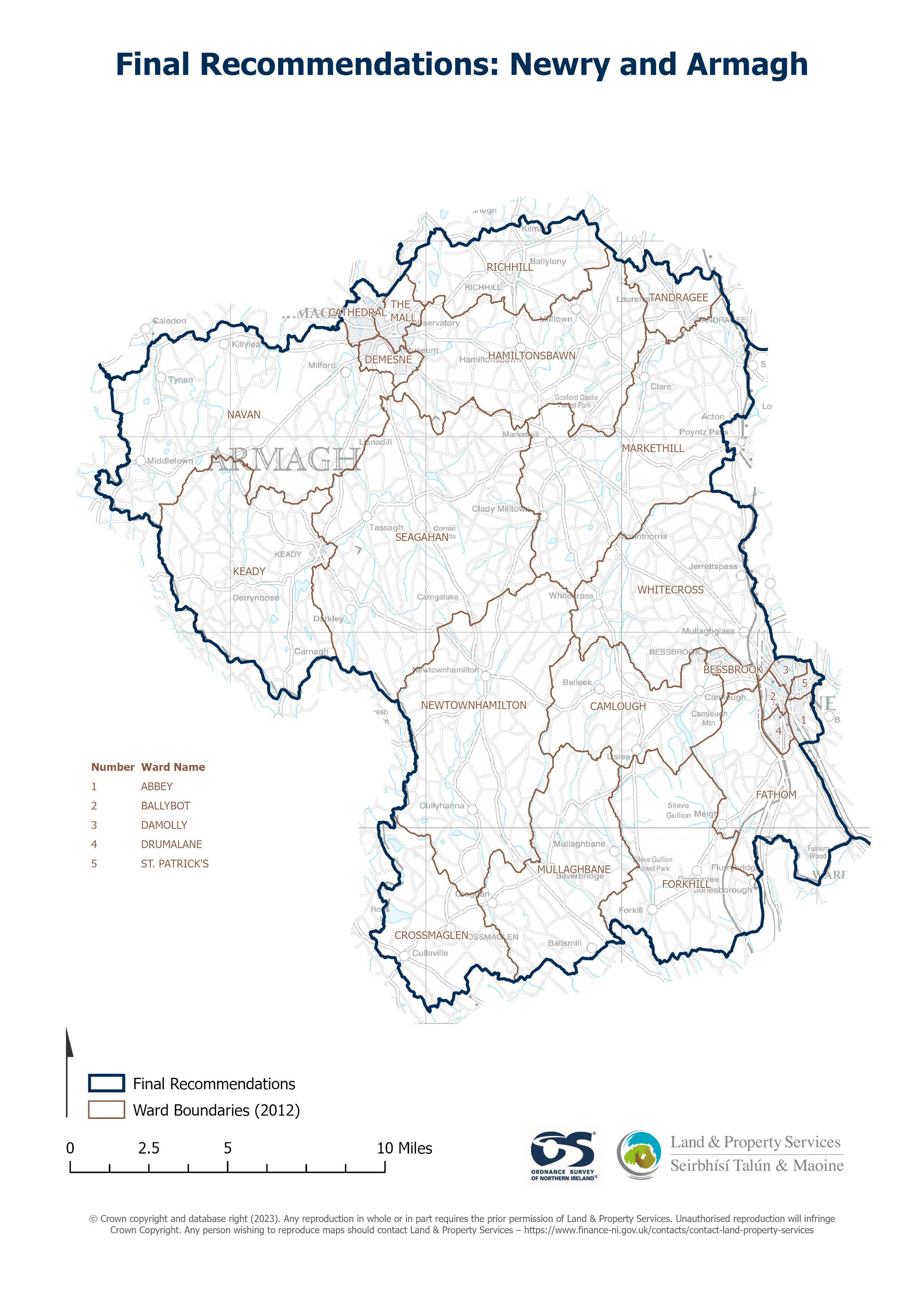
Raster download of Parliamentary Constituency 2023 of Newry and Armagh. The OSNI Large-scale Parliamentary Constituencies boundaries is a dataset consisting of official boundaries as...
Avots: OSNI OpenData - Parliamentary Constituencies 2023 - Newry and Armagh
Šim resursam pašreiz vēl nav izveidots skats.
Papildus informācija
| Lauks | Vērtība |
|---|---|
| Metadata last updated | 2025. gada 27. augusts |
| Izveidots | 2025. gada 27. augusts |
| Formāts | JSON |
| Licence | UK Open Government Licence (OGL) |
| Access url | https://docs.spatialni.gov.uk/OpenData/OSNIOpenData_ParliamentaryConstituencies2023/PC2023_Newry_and_Armagh.png |
| Datastore active | False |
| Distribution ref | Nceb8ced59ef94498b89b850e202f0004 |
| Has views | False |
| Id | dbe0187e-cd5a-4fcd-809c-0f3be37dfb64 |
| Mimetype | application/json |
| Package id | 110f65fb-a781-44bc-a2bf-758d9bb68b7c |
| Position | 1 |
| Requested | False |
| State | active |