ArcGIS GeoService
Dataset description:
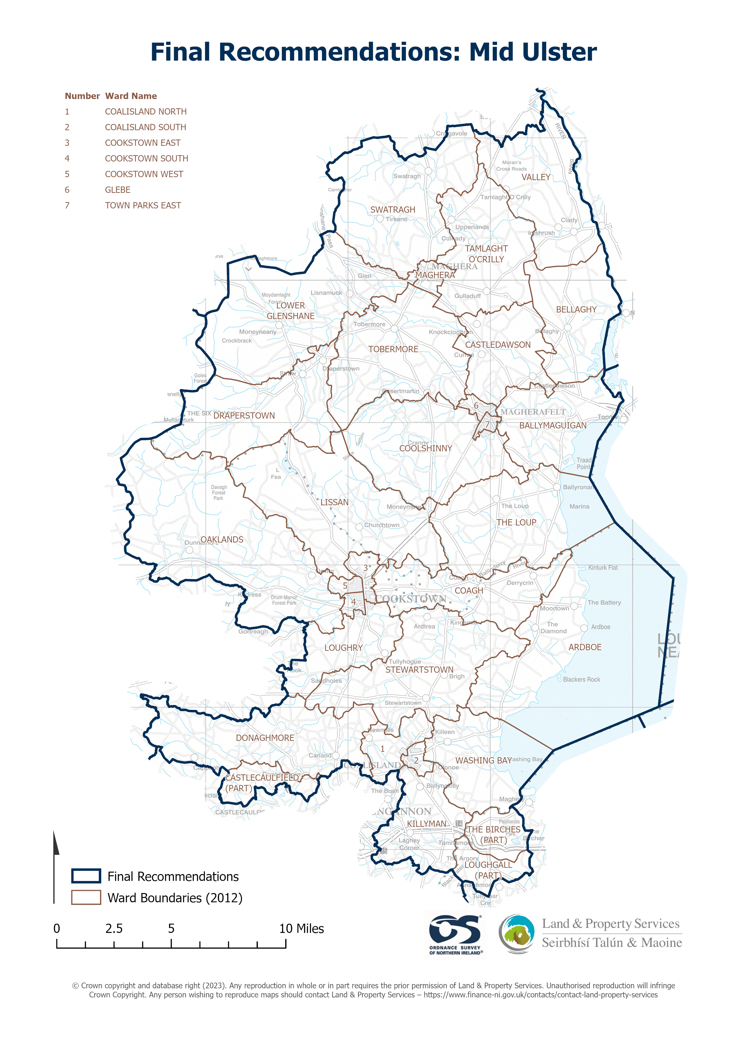
Raster download of Parliamentary Constituency 2023 of Mid Ulster. The OSNI Large-scale Parliamentary Constituencies boundaries is a dataset consisting of official boundaries as agreed by...
Avots: OSNI OpenData - Parliamentary Constituencies 2023 - Mid Ulster
Šim resursam pašreiz vēl nav izveidots skats.
Papildus informācija
| Lauks | Vērtība |
|---|---|
| Metadata last updated | 2024. gada 21. septembris |
| Izveidots | 2024. gada 21. septembris |
| Formāts | JSON |
| Licence | UK Open Government Licence (OGL) |
| Datastore active | False |
| Has views | False |
| Id | 8e68fb26-359f-4ae3-bab0-59af405262bd |
| Mimetype | application/json |
| Package id | c878a691-25a5-482e-af52-713c45b41135 |
| Position | 0 |
| Requested | False |
| State | active |
| Uri | None |