ArcGIS GeoService
Dataset description:
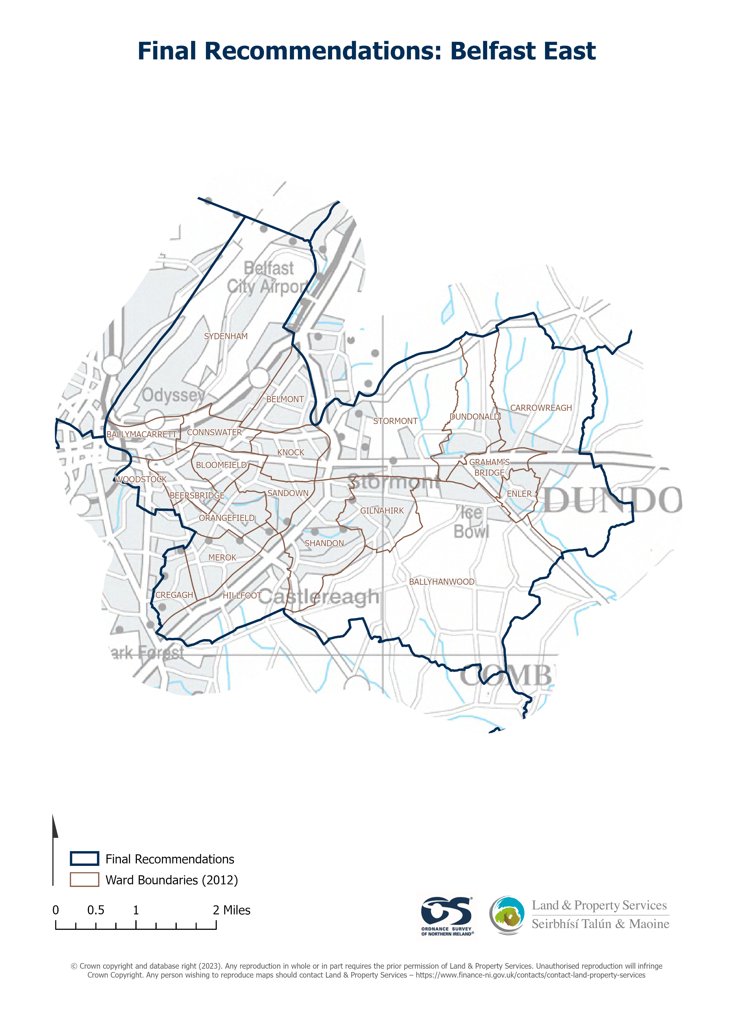
Raster download of Parliamentary Constituency 2023 of Belfast East. The OSNI Large-scale Parliamentary Constituencies boundaries is a dataset consisting of official boundaries as agreed...
Sorgente: OSNI OpenData - Parliamentary Constituencies 2023 - Belfast East
Non è stata ancora creata alcuna vista per questa risorsa.
Informazioni supplementari
| Campo | Valore |
|---|---|
| Metadata last updated | 29 maggio 2025 |
| Creato | 29 maggio 2025 |
| Formato | JSON |
| Licenza | UK Open Government Licence (OGL) |
| Datastore active | False |
| Has views | False |
| Id | 69301391-39be-42d0-bd69-4b485e241815 |
| Mimetype | application/json |
| Package id | e7101207-5639-46ac-891f-47da37bd4bfe |
| Position | 1 |
| Requested | False |
| State | active |