ArcGIS GeoService
Dataset description:
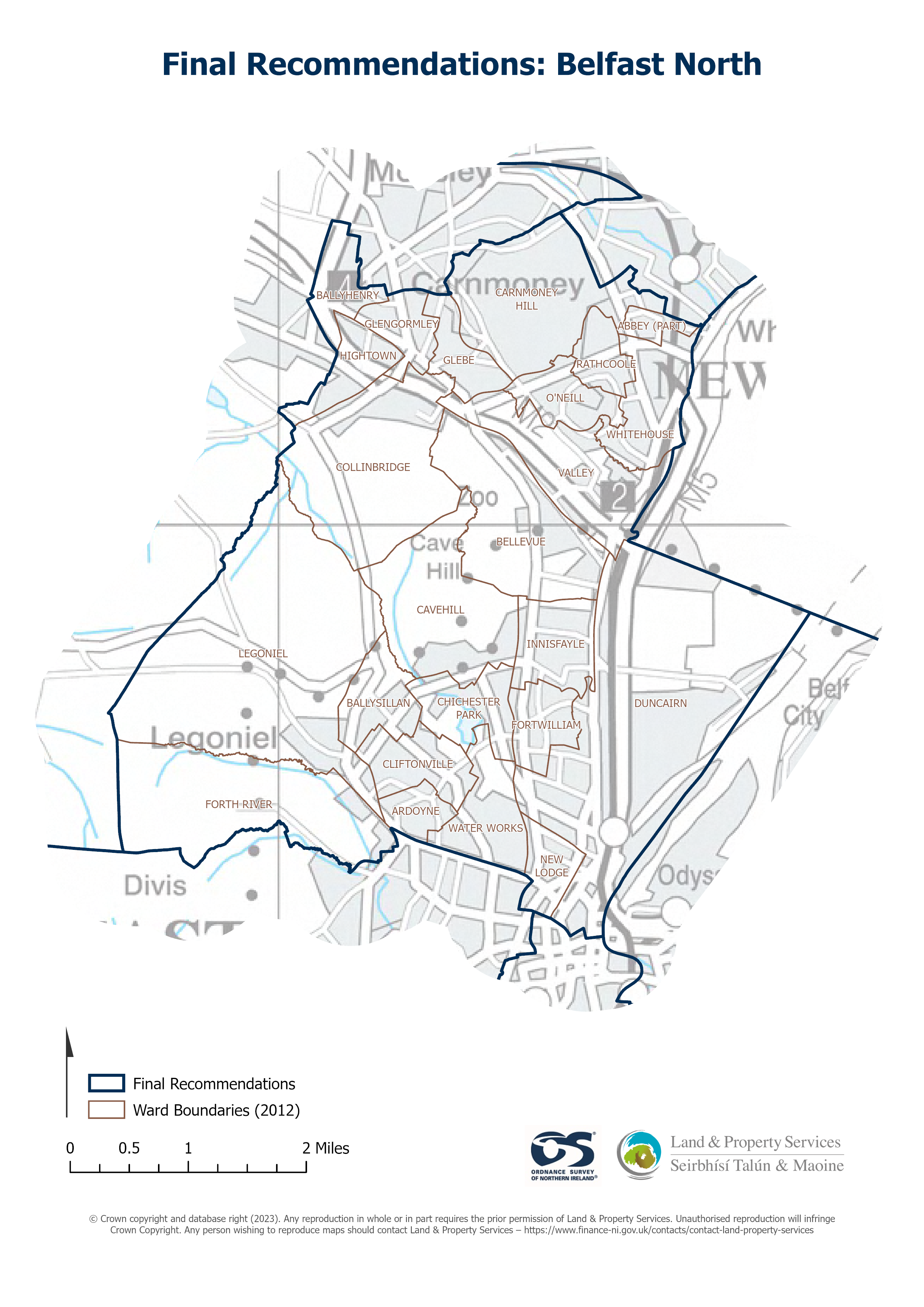
Raster download of Parliamentary Constituency 2023 of Belfast North. The OSNI Large-scale Parliamentary Constituencies boundaries is a dataset consisting of official boundaries as agreed...
Heimild: OSNI OpenData - Parliamentary Constituencies 2023 - Belfast North
Það hafa engar sýnir verið búnar til fyrir þetta tilfang.
Viðbótarupplýsingar
| Svæði | Gildi |
|---|---|
| Metadata last updated | 27. ágúst 2025 |
| Stofnað | 27. ágúst 2025 |
| Skráasnið | JSON |
| Leyfisskilmálar | UK Open Government Licence (OGL) |
| Access url | https://docs.spatialni.gov.uk/OpenData/OSNIOpenData_ParliamentaryConstituencies2023/PC2023_Belfast_North.png |
| Datastore active | False |
| Distribution ref | Nb5ddfaa195604a4c9f394d177d04eb07 |
| Has views | False |
| Id | b8660393-032b-4e90-b831-8e9054d53189 |
| Mimetype | application/json |
| Package id | b6d3b01b-0b18-4bda-9218-8160f06ac52b |
| Position | 1 |
| Requested | False |
| State | active |