ArcGIS GeoService
Datensatzbeschreibung:
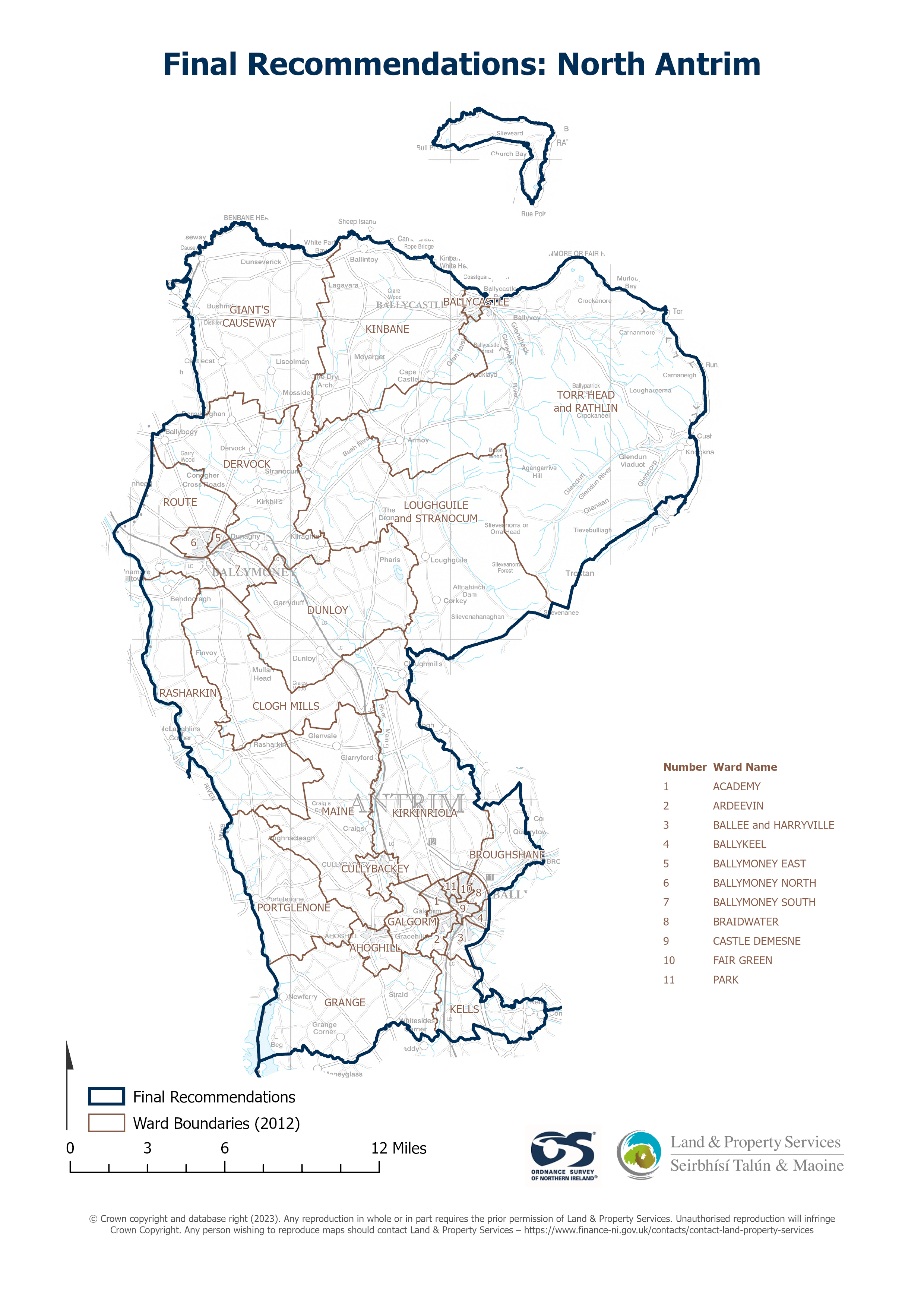
Raster download of Parliamentary Constituency 2023 of North Antrim. The OSNI Large-scale Parliamentary Constituencies boundaries is a dataset consisting of official boundaries as agreed...
Quelle: OSNI OpenData - Parliamentary Constituencies 2023 - North Antrim
Es gibt noch keine Darstellungen/Views für diese Ressource
Zusätzliche Informationen
| Feld | Wert |
|---|---|
| Metadaten zuletzt aktualisiert | 21. September 2024 |
| Erstellt | 21. September 2024 |
| Format | JSON |
| Lizenz | UK Open Government Licence (OGL) |
| Datastore active | False |
| Has views | False |
| Id | 61d1404d-19b4-40ab-842d-65ae3c2e52e1 |
| Mimetype | application/json |
| Package id | de2cc9c0-7c74-4e88-9c10-6adbbf64ad6e |
| Position | 1 |
| Requested | False |
| State | active |
| Uri | None |