ArcGIS GeoService
URL: https://docs.spatialni.gov.uk/OpenData/OSNIOpenData_ParliamentaryConstituencies2023/PC2023_Foyle.png
Datensatzbeschreibung:
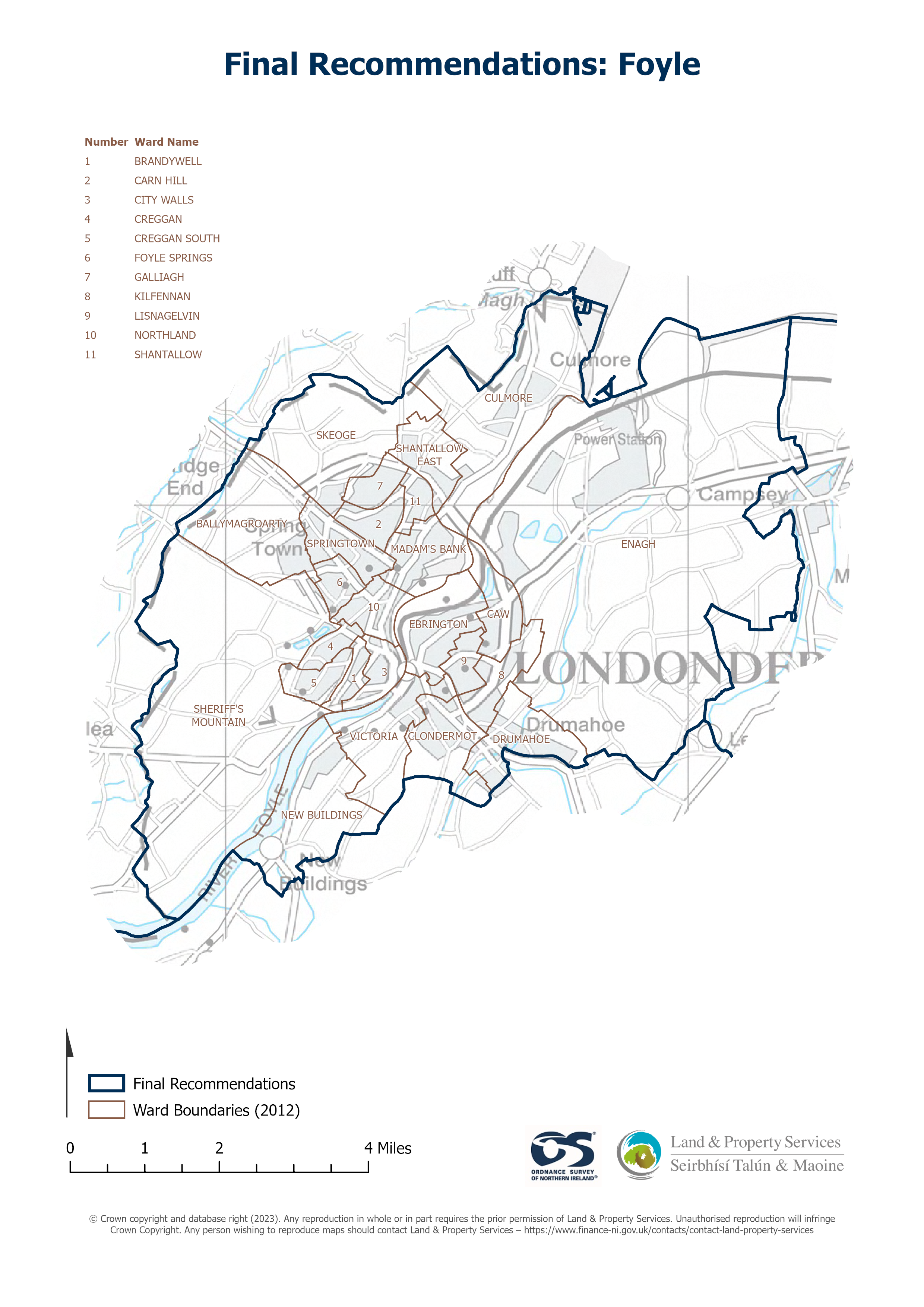
Raster download of Parliamentary Constituency 2023 of Foyle. The OSNI Large-scale Parliamentary Constituencies boundaries is a dataset consisting of official boundaries as agreed by The...
Quelle: OSNI OpenData - Parliamentary Constituencies 2023 - Foyle
Es gibt noch keine Darstellungen/Views für diese Ressource
Zusätzliche Informationen
| Feld | Wert |
|---|---|
| Metadaten zuletzt aktualisiert | 30. August 2025 |
| Erstellt | 30. August 2025 |
| Format | JSON |
| Lizenz | UK Open Government Licence (OGL) |
| Access url | https://docs.spatialni.gov.uk/OpenData/OSNIOpenData_ParliamentaryConstituencies2023/PC2023_Foyle.png |
| Datastore active | False |
| Distribution ref | Nf56f8645cef8463b8835f5f95e65ed83 |
| Has views | False |
| Id | 2a508894-5054-419a-ab8c-c85abdfa41e3 |
| Mimetype | application/json |
| Package id | ee9ecb9b-a744-420d-9585-be0b43f79e98 |
| Position | 1 |
| Requested | False |
| State | active |