ArcGIS GeoService
Datensatzbeschreibung:
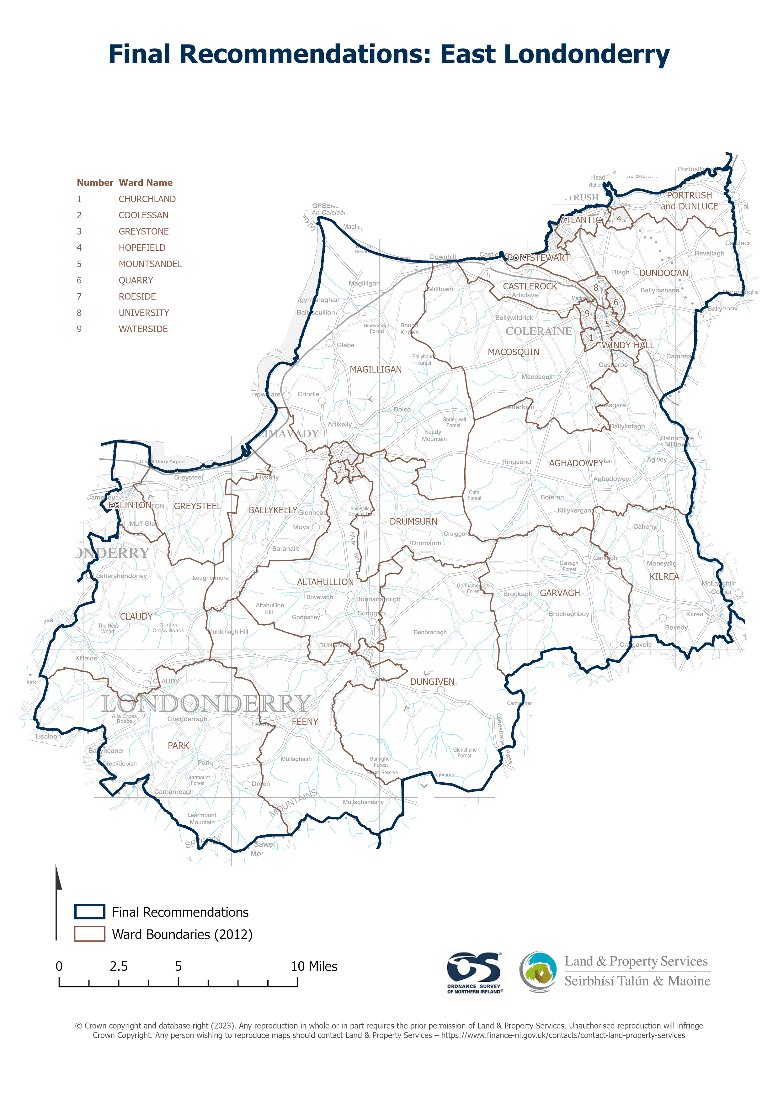
Raster download of Parliamentary Constituency 2023 of East Londonderry. The OSNI Large-scale Parliamentary Constituencies boundaries is a dataset consisting of official boundaries as...
Quelle: OSNI OpenData - Parliamentary Constituencies 2023 - East Londonderry
Es gibt noch keine Darstellungen/Views für diese Ressource
Zusätzliche Informationen
| Feld | Wert |
|---|---|
| Metadaten zuletzt aktualisiert | 27. August 2025 |
| Erstellt | 27. August 2025 |
| Format | JSON |
| Lizenz | UK Open Government Licence (OGL) |
| Access url | https://docs.spatialni.gov.uk/OpenData/OSNIOpenData_ParliamentaryConstituencies2023/PC2023_East_Londonderry.png |
| Datastore active | False |
| Distribution ref | N3ae4eead16814f60a087cde24040990e |
| Has views | False |
| Id | a0c396ae-599b-4547-9e26-ac0684d1e699 |
| Mimetype | application/json |
| Package id | 418e7c15-fba6-4839-ba64-0c96d9ae99e5 |
| Position | 1 |
| Requested | False |
| State | active |